- Culturally interesting
Rothaarsteig from the source of the Lahn to Irmgarteichen
Tour starting point:
Lahnquelle
Tour destination point:
Town center in Netphen-Irmgarteichen
Properties:
Additional Information
There are no refreshment stops on this stage. Please remember to bring enough food and drink. Further information about the Rothaarsteig can be found at www.rothaarsteig.de or by calling the free service hotline on +49 2974 / 499 4163, where we will be happy to advise you personally on your tour planningCategory
regionaler WanderwegLength
13.2 kmDuration
3:00 hElevation ascent
170 mElevation descent
340 mLowest point
448 mHighest point
674 mCondition
Difficulty
Information
Directions
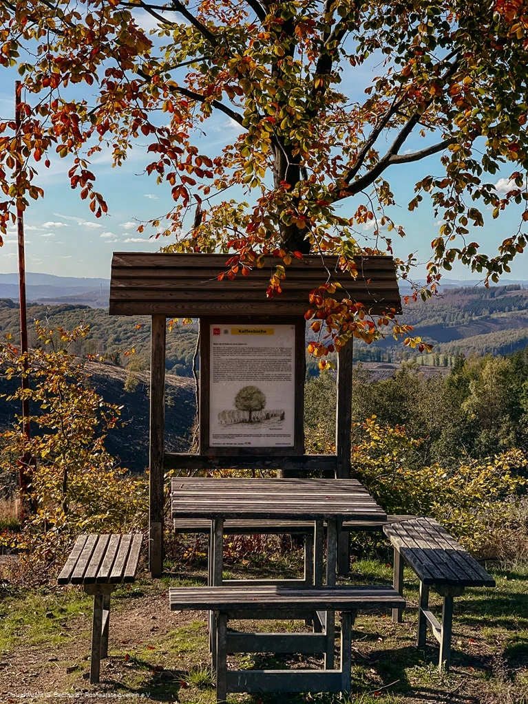
Lahnqelle - Ochsenborn - Historic Iron Road - Ilsequelle - Jagdberg - Kaffeebuche - Haincher Höhe - Irmgarteichen
Equipment
In our small hiking store at www.rothaarsteig.de/shop you will also find a selection of Rothaarsteig items to prepare for your tour or as a souvenir. We are also happy to recommend the durable and high-quality outdoor equipment from our long-standing partner, the outdoor outfitter Tatonka.
Hiking rucksack
A suitable hiking rucksack will make your tour on the Rothaarsteig twice as much fun! Hiking rucksacks have a ventilated carrying system that makes them very comfortable to wear, as this ensures that sweat can evaporate immediately. They can be fastened with a waist or hip belt and thus sit firmly on your back with every movement. They are also equipped with a practical holder for hiking poles and often have a compartment with a tube outlet for a hydration bladder, so that hydration is ensured at all times.
First aid kit
To make sure you can enjoy your hiking tour on the Rothaarsteig to the full, a first aid kit should be in your rucksack. After all, nothing is more annoying than not being able to immediately treat a blister on your foot or minor injuries. The first aid kits from Tatonka are filled with all the important materials for first aid treatment of injuries and also contain an "outdoor cheat sheet" with a concise and clear guide to the correct behavior in the event of emergencies in the great outdoors.
Here you can find the first aid kits from Tatonka!
Food and drinks
On some stages, especially between Lahnhof and Dillenburg, there are unfortunately no refreshment stops along the way. Remember to pack food and drink, especially here. Especially in summer it is important to stay hydrated.
Safety guidelines
Most hiking trails run away from towns and settlements and all hikers have certainly thought about what would happen if an emergency were to occur. How can I be found here? Where am I anyway? Can the emergency services reach me?
In an emergency, things have to happen quickly! That's why the Rothaarsteig is equipped with so-called rescue signs throughout. On the green and white plaques attached to the posts of the signposts, there is a combination of letters and numbers that you must enter when making an emergency call. This way, the emergency services know exactly where you are and valuable time can be saved.
Note on the increased risk of forest fires
Please bear in mind that there is currently an increased risk of forest fires due to the drought! Therefore, please observe the following instructions:
- Observe the legal ban on smoking in the forest - it applies in spring, summer and fall, more precisely: from March 1 to October 31.
- Observe the ban on open fires in the forest and within 100 meters of the forest.
- Take glass out of the forest - the burning glass effect can cause forest fires.
When it is (too) late:
- Extinguish small incipient fires if you can do so safely. Check the area carefully if necessary.
- Report fires via "112".
- Leave the danger zone by the shortest route.
The forest will thank you!
Author Tip
- Lahnquelle
- Ilse spring
- Coffee beech rest area
Restaurants:
- Hotel Fünf10
- Pension zum Rothaarsteig
- Romantic country hotel Doerr
- Hotel in the Auerbach Valley
- Guesthouse Pension Jokebes
All the accommodations mentioned are certified as Rothaarsteig quality establishments and offer a transfer to and from the Rothaarsteig for a small surcharge. Unfortunately, there are no refreshment stops along the way.
Literature
To help you prepare for your hike, we will be happy to send you our free information pack. At www.rothaarst eig.de/prospekte you can easily select the information you need. A good companion for every tour is our brochure "Rothaarsteig Wegweiser" (Rothaarsteig Trail Guide) with the hosts along the trail and other useful information.
The Rothaarsteig recommends:
Maps
The original Rothaarsteig hiking map at a scale of 1:50,000, divided into two sheets (sheet north / sheet south), with up-to-date route guidance and useful markings such as shelters, parking lots, bus stops and much more can be ordered free of shipping costs at www.rothaarsteig.de/wanderkarte.
Public transit
The starting point of this tour at the source of the Lahn is unfortunately not accessible by public transport. The end point of this tour can be reached by bus line R16 from the train station in Siegen (bus stop: Irmgarteichen Kirche, Netphen).
Parking
Parking at the starting point of the stage: Lahnhof hiking parking lot
Parking at the end of the stage: Glockenstraße in Netphen-Irmgarteichen

